PlacesProvince
Balochistan
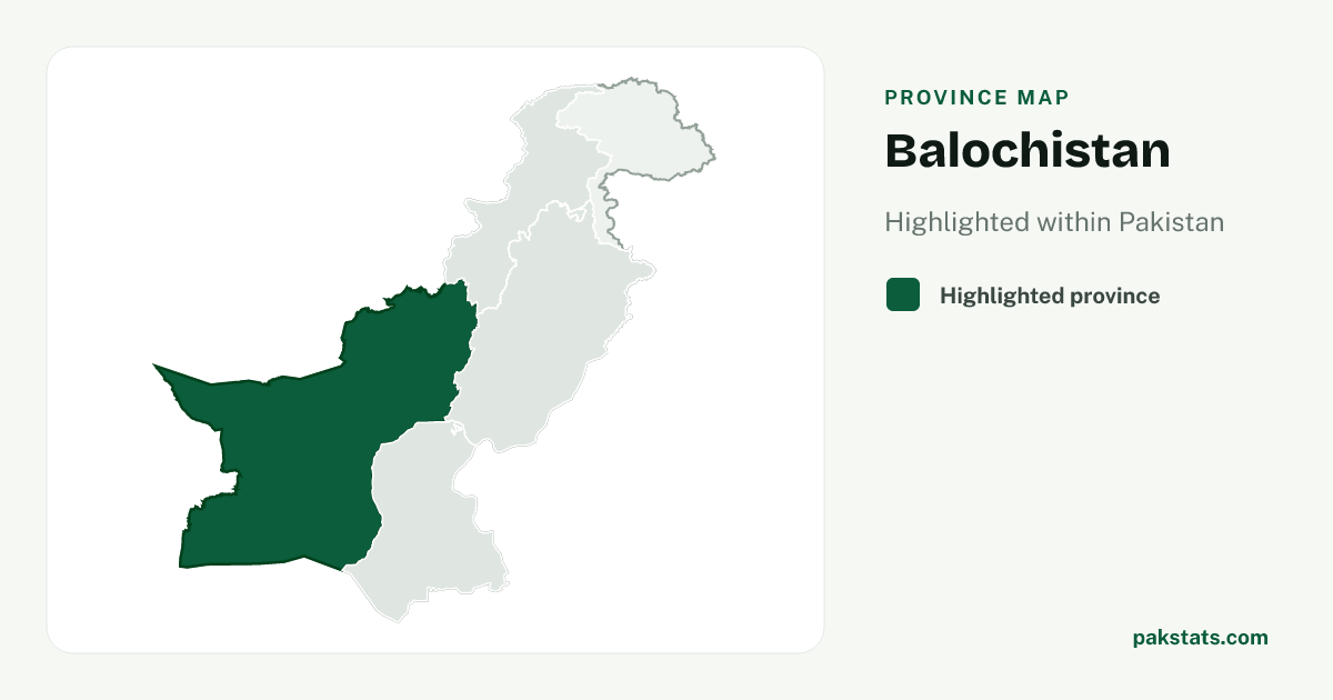
Balochistan has 14,894,402 people and covers 347,190 sq km.
Province map
Map of Balochistan
14,894,402
People counted in the 2023 census
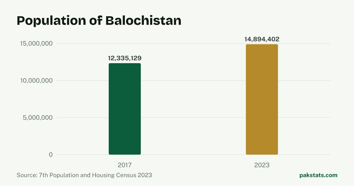
Change since 2017
| Census | People |
|---|---|
| 2023 | 14,894,402 |
| 2017 | 12,335,129 |
Key numbers
- 347,190 sq kmArea
- 42.9People per sq km
- 31.0%Share living in towns and cities
- 6.4People per household
- 109.02Men per 100 women
- 3.20%Population growth a year
Who lives here
| Group | People | Share |
|---|---|---|
| Men | 7,768,166 | 52.2% |
| Women | 7,125,471 | 47.8% |
| Transgender people | 765 | 0.0% |
| People in villages | 10,282,574 | 69.0% |
| People in towns and cities | 4,611,828 | 31.0% |
Literacy and school attendance
PBS defines this literacy rate for people aged 10 and older. Rural and urban values are shown only where the census reports them.
| Group | Literacy rate |
|---|---|
| Overall | 42.0% |
| Men | 50.5% |
| Women | 32.8% |
| Rural | 35.7% |
| Urban | 55.9% |
2,941,690 children aged 5–16 were recorded as out of school.
Inside Balochistan
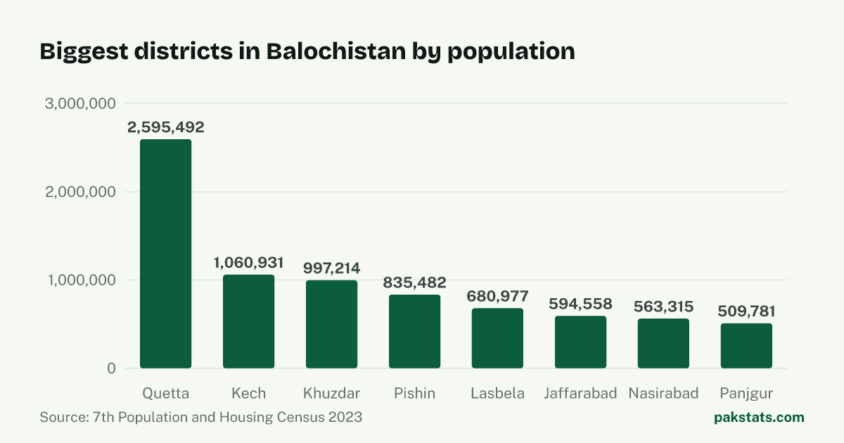
| District | People | Area (sq km) | Share |
|---|---|---|---|
| Quetta | 2,595,492 | 3,447 sq km | 17.4% |
| Kech | 1,060,931 | 22,539 sq km | 7.1% |
| Khuzdar | 997,214 | 35,380 sq km | 6.7% |
| Pishin | 835,482 | 6,218 sq km | 5.6% |
| Lasbela | 680,977 | 15,153 sq km | 4.6% |
| Jaffarabad | 594,558 | 1,643 sq km | 4.0% |
| Nasirabad | 563,315 | 3,387 sq km | 3.8% |
| Panjgur | 509,781 | 16,891 sq km | 3.4% |
| Chaman | 466,218 | 1,341 sq km | 3.1% |
| Kachhi | 442,674 | 5,682 sq km | 3.0% |
| Killa Saifullah | 380,200 | 6,831 sq km | 2.6% |
| Killa Abdullah | 361,971 | 3,553 sq km | 2.4% |
| Zhob | 355,692 | 15,987 sq km | 2.4% |
| Dera Bugti | 355,274 | 10,160 sq km | 2.4% |
| Mastung | 313,271 | 3,308 sq km | 2.1% |
| Gwadar | 305,160 | 12,637 sq km | 2.0% |
| Washuk | 302,623 | 33,093 sq km | 2.0% |
| Surab | 279,038 | 762 sq km | 1.9% |
| Loralai | 272,432 | 3,785 sq km | 1.8% |
| Kalat | 271,560 | 7,654 sq km | 1.8% |
| Chagai | 269,192 | 44,748 sq km | 1.8% |
| Kharan | 260,352 | 14,958 sq km | 1.7% |
| Kohlu | 260,220 | 7,610 sq km | 1.7% |
| Sohbatpur | 240,106 | 802 sq km | 1.6% |
| Sibi | 224,148 | 7,121 sq km | 1.5% |
| Barkhan | 210,249 | 3,514 sq km | 1.4% |
| Nushki | 207,834 | 5,797 sq km | 1.4% |
| Duki | 205,044 | 4,233 sq km | 1.4% |
| Jhal Magsi | 203,368 | 3,615 sq km | 1.4% |
| Sherani | 191,687 | 4,310 sq km | 1.3% |
| Ziarat | 189,535 | 3,301 sq km | 1.3% |
| Musakhel | 182,275 | 5,728 sq km | 1.2% |
| Awaran | 178,958 | 29,510 sq km | 1.2% |
| Harnai | 127,571 | 2,492 sq km | 0.9% |
Common questions about Balochistan
- What is the population of Balochistan?
- Balochistan had 14,894,402 people in the 2023 census. The 2017 census counted 12,335,129, so there are 2,559,273 more people now.
- How fast is Balochistan growing?
- The population of Balochistan grew 3.20% a year between the 2017 and 2023 censuses. That is faster than Pakistan as a whole, which grew 2.55% a year.
- How big is Balochistan?
- Balochistan covers 347,190 square kilometres. That works out at 42.9 people per square kilometre. A household here holds 6.4 people on average.
- How many people in Balochistan live in towns and cities?
- 4,611,828 people in Balochistan live in towns and cities and 10,282,574 live in villages. That makes it 31.0% urban.
- How many men and women live in Balochistan?
- The census counted 7,768,166 men and 7,125,471 women in Balochistan. It also counted 765 transgender people. That is 109.02 men for every 100 women.
- What is the literacy rate in Balochistan?
- The 2023 census literacy rate for people aged 10 and older in Balochistan was 42.0%. It was 50.5% for men and 32.8% for women, a gap of 17.7 percentage points.