Rawalpindi District
Rawalpindi District in Punjab has 6,118,911 people and covers 5,285 sq km.
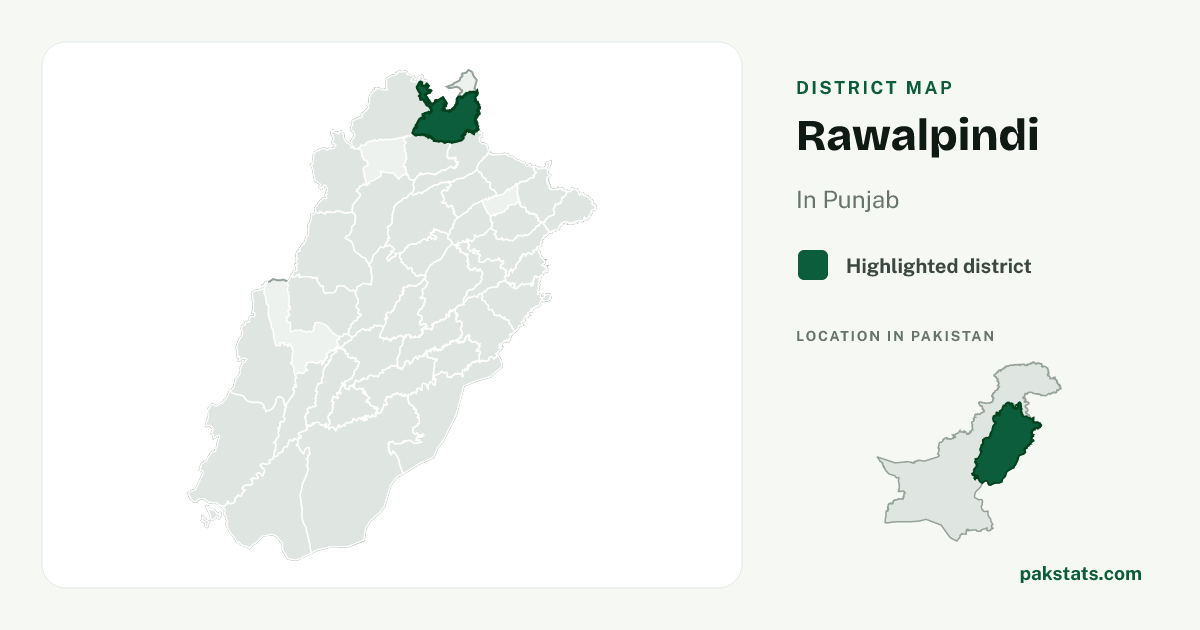
District map
Map of Rawalpindi
6,118,911
People counted in the 2023 census
3rd of 36 districts in Punjab. 4.8% of Punjab
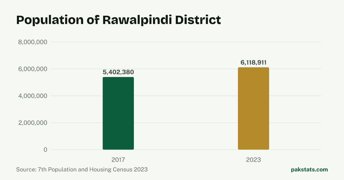
Change since 2017
| Census | People |
|---|---|
| 2023 | 6,118,911 |
| 2017 | 5,402,380 |
Key numbers
- 5,285 sq kmArea2.6% of Punjab
- 1,157.8People per sq kmAbove the Punjab figure of 621.8
- 68.8%Share living in towns and citiesAbove the Punjab figure of 40.7%
- 6.1People per householdBelow the Punjab figure of 6.4
- 103.39Men per 100 womenBelow the Punjab figure of 105.18
- 2.10%Population growth a yearBelow the Punjab figure of 2.53%
Who lives here
| Group | People | Share |
|---|---|---|
| Men | 3,109,807 | 50.8% |
| Women | 3,007,760 | 49.2% |
| Transgender people | 1,344 | 0.0% |
| People in villages | 1,908,126 | 31.2% |
| People in towns and cities | 4,210,785 | 68.8% |
Literacy and school attendance
PBS defines this literacy rate for people aged 10 and older. Rural and urban values are shown only where the census reports them.
| Group | Literacy rate |
|---|---|
| Overall | 83.2% |
| Men | 87.9% |
| Women | 78.4% |
| Rural | 80.7% |
| Urban | 84.4% |
239,415 children aged 5–16 were recorded as out of school.
How this place ranks in Pakistan
All rankingsPublic transit routes
The PakBus GTFS feed listed 10 routes in 3 services for Rawalpindi on : Electric feeder bus, Feeder bus, Metro Bus Red Line. These are route records, not a count of journeys or a live service status. City names follow PakBus and do not define census boundaries.
Inside Rawalpindi
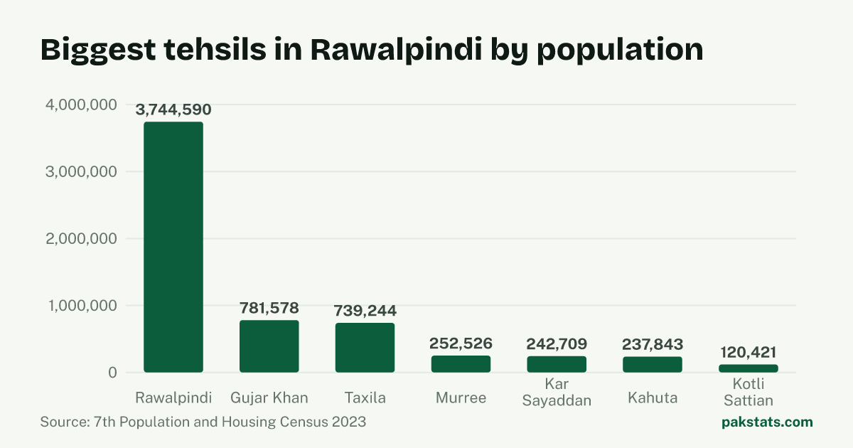
| Tehsil | People | Area (sq km) | Share |
|---|---|---|---|
| Rawalpindi | 3,744,590 | 1,682 sq km | 61.2% |
| Gujar Khan | 781,578 | 1,457 sq km | 12.8% |
| Taxila | 739,244 | 312 sq km | 12.1% |
| Murree | 252,526 | 434 sq km | 4.1% |
| Kar Sayaddan | 242,709 | 459 sq km | 4.0% |
| Kahuta | 237,843 | 637 sq km | 3.9% |
| Kotli Sattian | 120,421 | 304 sq km | 2.0% |
Common questions about Rawalpindi
- What is the population of Rawalpindi District?
- Rawalpindi District had 6,118,911 people in the 2023 census. That is the 3rd largest of the 36 districts in Punjab, and 4.8% of everyone there. The 2017 census counted 5,402,380, so there are 716,531 more people now.
- How fast is Rawalpindi growing?
- The population of Rawalpindi grew 2.10% a year between the 2017 and 2023 censuses. That is slower than Pakistan as a whole, which grew 2.55% a year.
- How big is Rawalpindi?
- Rawalpindi covers 5,285 square kilometres. That works out at 1,157.8 people per square kilometre. A household here holds 6.1 people on average.
- How many people in Rawalpindi live in towns and cities?
- 4,210,785 people in Rawalpindi live in towns and cities and 1,908,126 live in villages. That makes it 68.8% urban, against 40.7% for Punjab.
- How many men and women live in Rawalpindi?
- The census counted 3,109,807 men and 3,007,760 women in Rawalpindi. It also counted 1,344 transgender people. That is 103.39 men for every 100 women.
- What is the literacy rate in Rawalpindi?
- The 2023 census literacy rate for people aged 10 and older in Rawalpindi was 83.2%. It was 87.9% for men and 78.4% for women, a gap of 9.5 percentage points.
- Where does Rawalpindi rank by population?
- Rawalpindi ranks 3rd of 136 districts in Pakistan by 2023 census population.