PlacesProvince
Sindh
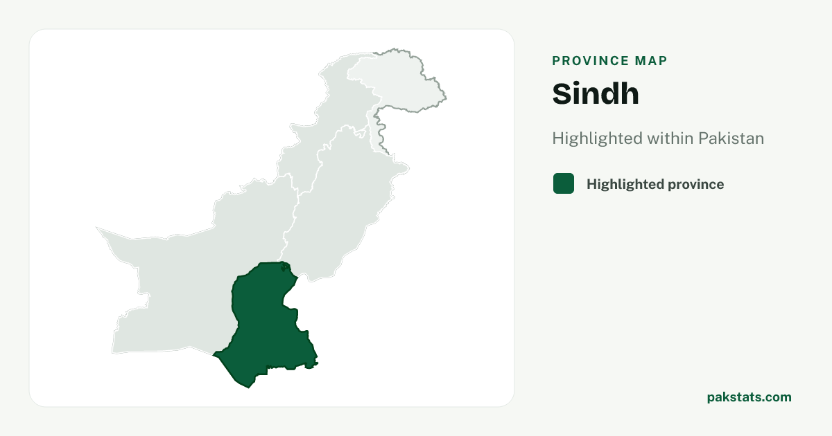
Sindh has 55,696,147 people and covers 140,914 sq km.
Province map
Map of Sindh
55,696,147
People counted in the 2023 census
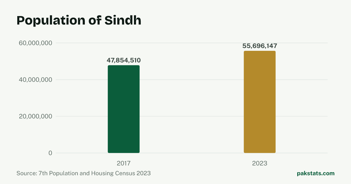
Change since 2017
| Census | People |
|---|---|
| 2023 | 55,696,147 |
| 2017 | 47,854,510 |
Key numbers
- 140,914 sq kmArea
- 395.3People per sq km
- 54.0%Share living in towns and cities
- 5.6People per household
- 108.76Men per 100 women
- 2.57%Population growth a year
Who lives here
| Group | People | Share |
|---|---|---|
| Men | 29,014,424 | 52.1% |
| Women | 26,677,501 | 47.9% |
| Transgender people | 4,222 | 0.0% |
| People in villages | 25,639,408 | 46.0% |
| People in towns and cities | 30,056,739 | 54.0% |
Literacy and school attendance
PBS defines this literacy rate for people aged 10 and older. Rural and urban values are shown only where the census reports them.
| Group | Literacy rate |
|---|---|
| Overall | 57.5% |
| Men | 64.2% |
| Women | 50.2% |
| Rural | 38.1% |
| Urban | 72.3% |
7,818,248 children aged 5–16 were recorded as out of school.
Inside Sindh
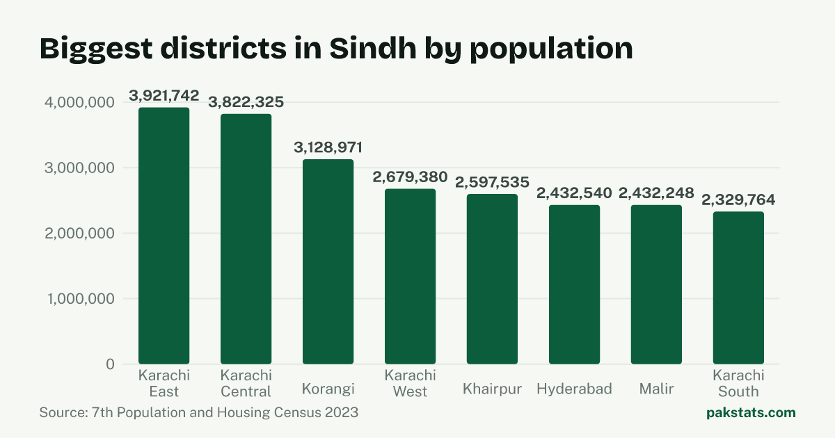
| District | People | Area (sq km) | Share |
|---|---|---|---|
| Karachi East | 3,921,742 | 139 sq km | 7.0% |
| Karachi Central | 3,822,325 | 69 sq km | 6.9% |
| Korangi | 3,128,971 | 108 sq km | 5.6% |
| Karachi West | 2,679,380 | 370 sq km | 4.8% |
| Khairpur | 2,597,535 | 15,910 sq km | 4.7% |
| Hyderabad | 2,432,540 | 993 sq km | 4.4% |
| Malir | 2,432,248 | 2,160 sq km | 4.4% |
| Karachi South | 2,329,764 | 122 sq km | 4.2% |
| Sanghar | 2,308,465 | 10,728 sq km | 4.1% |
| Keamari | 2,068,451 | 559 sq km | 3.7% |
| Badin | 1,947,081 | 6,858 sq km | 3.5% |
| Shaheed Benazirabad | 1,845,102 | 4,502 sq km | 3.3% |
| Larkana | 1,784,453 | 1,948 sq km | 3.2% |
| Tharparkar | 1,778,407 | 19,637 sq km | 3.2% |
| Naushahro Feroze | 1,777,082 | 2,946 sq km | 3.2% |
| Ghotki | 1,772,609 | 6,083 sq km | 3.2% |
| Dadu | 1,742,320 | 7,866 sq km | 3.1% |
| Mirpur Khas | 1,681,386 | 2,925 sq km | 3.0% |
| Sukkur | 1,639,897 | 5,165 sq km | 2.9% |
| Kambar Shahdad Kot | 1,514,869 | 5,475 sq km | 2.7% |
| Shikarpur | 1,386,330 | 2,512 sq km | 2.5% |
| Kashmore | 1,233,957 | 2,580 sq km | 2.2% |
| Jacobabad | 1,174,097 | 2,698 sq km | 2.1% |
| Umer Kot | 1,159,831 | 5,608 sq km | 2.1% |
| Jamshoro | 1,117,308 | 11,204 sq km | 2.0% |
| Thatta | 1,083,191 | 8,570 sq km | 1.9% |
| Tando Ahyar | 922,012 | 1,554 sq km | 1.7% |
| Matiari | 849,383 | 1,417 sq km | 1.5% |
| Sujawal | 839,292 | 8,785 sq km | 1.5% |
| Tando Muhammad Khan | 726,119 | 1,423 sq km | 1.3% |
Common questions about Sindh
- What is the population of Sindh?
- Sindh had 55,696,147 people in the 2023 census. The 2017 census counted 47,854,510, so there are 7,841,637 more people now.
- How fast is Sindh growing?
- The population of Sindh grew 2.57% a year between the 2017 and 2023 censuses. That is faster than Pakistan as a whole, which grew 2.55% a year.
- How big is Sindh?
- Sindh covers 140,914 square kilometres. That works out at 395.3 people per square kilometre. A household here holds 5.6 people on average.
- How many people in Sindh live in towns and cities?
- 30,056,739 people in Sindh live in towns and cities and 25,639,408 live in villages. That makes it 54.0% urban.
- How many men and women live in Sindh?
- The census counted 29,014,424 men and 26,677,501 women in Sindh. It also counted 4,222 transgender people. That is 108.76 men for every 100 women.
- What is the literacy rate in Sindh?
- The 2023 census literacy rate for people aged 10 and older in Sindh was 57.5%. It was 64.2% for men and 50.2% for women, a gap of 14.0 percentage points.