Badin District
Badin District in Sindh has 1,947,081 people and covers 6,858 sq km.
District map
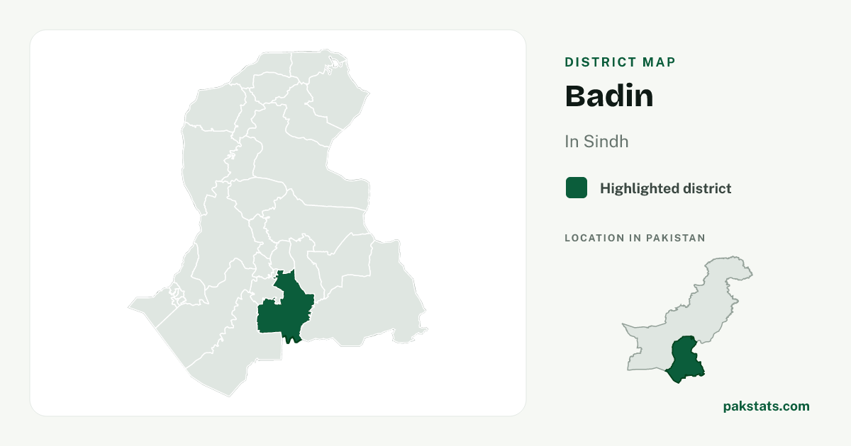
Map of Badin
1,947,081
People counted in the 2023 census
11th of 30 districts in Sindh. 3.5% of Sindh
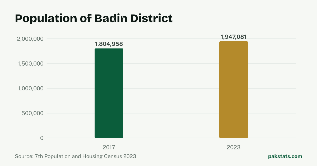
Change since 2017
| Census | People |
|---|---|
| 2023 | 1,947,081 |
| 2017 | 1,804,958 |
Key numbers
- 6,858 sq kmArea4.9% of Sindh
- 283.9People per sq kmBelow the Sindh figure of 395.3
- 22.1%Share living in towns and citiesBelow the Sindh figure of 54.0%
- 4.8People per householdBelow the Sindh figure of 5.6
- 108.42Men per 100 womenBelow the Sindh figure of 108.76
- 1.27%Population growth a yearBelow the Sindh figure of 2.57%
Who lives here
| Group | People | Share |
|---|---|---|
| Men | 1,012,854 | 52.0% |
| Women | 934,153 | 48.0% |
| Transgender people | 74 | 0.0% |
| People in villages | 1,517,232 | 77.9% |
| People in towns and cities | 429,849 | 22.1% |
Literacy and school attendance
PBS defines this literacy rate for people aged 10 and older. Rural and urban values are shown only where the census reports them.
| Group | Literacy rate |
|---|---|
| Overall | 36.6% |
| Men | 46.5% |
| Women | 26.0% |
| Rural | 31.5% |
| Urban | 53.7% |
381,384 children aged 5–16 were recorded as out of school.
How this place ranks in Pakistan
All rankingsInside Badin
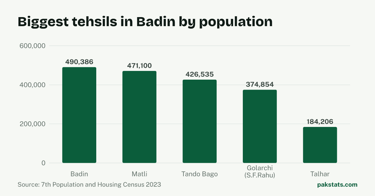
| Tehsil | People | Area (sq km) | Share |
|---|---|---|---|
| Badin | 490,386 | 1,816 sq km | 25.2% |
| Matli | 471,100 | 1,143 sq km | 24.2% |
| Tando Bago | 426,535 | 1,688 sq km | 21.9% |
| Golarchi (S.F.Rahu) | 374,854 | 1,642 sq km | 19.3% |
| Talhar | 184,206 | 569 sq km | 9.5% |
Common questions about Badin
- What is the population of Badin District?
- Badin District had 1,947,081 people in the 2023 census. That is the 11th largest of the 30 districts in Sindh, and 3.5% of everyone there. The 2017 census counted 1,804,958, so there are 142,123 more people now.
- How fast is Badin growing?
- The population of Badin grew 1.27% a year between the 2017 and 2023 censuses. That is slower than Pakistan as a whole, which grew 2.55% a year.
- How big is Badin?
- Badin covers 6,858 square kilometres. That works out at 283.9 people per square kilometre. A household here holds 4.8 people on average.
- How many people in Badin live in towns and cities?
- 429,849 people in Badin live in towns and cities and 1,517,232 live in villages. That makes it 22.1% urban, against 54.0% for Sindh.
- How many men and women live in Badin?
- The census counted 1,012,854 men and 934,153 women in Badin. It also counted 74 transgender people. That is 108.42 men for every 100 women.
- What is the literacy rate in Badin?
- The 2023 census literacy rate for people aged 10 and older in Badin was 36.6%. It was 46.5% for men and 26.0% for women, a gap of 20.5 percentage points.
- Where does Badin rank by population?
- Badin ranks 43rd of 136 districts in Pakistan by 2023 census population.